In many parts of the world, heavy, frequent rainstorms are catastrophic events that cause mudslides, flooding and loss of life.
An international team of experts led by Colorado State University atmospheric scientists are spending this summer getting to the bottom of how and why the most violent rainstorms in the world occur. By identifying the key physical processes and environmental ingredients that cause high-intensity, long-duration rain events, their goal is to improve models for forecasters and eventually save lives.
The team is led by Michael Bell and Kristen Rasmussen, both faculty members in the Department of Atmospheric Science, and includes collaborators from the National Center for Atmospheric Research in Boulder, seven other U.S. academic institutions and several international partners in Taiwan, Japan and Korea. The $6 million-plus field campaign is supported by the National Science Foundation and is called PRECIP, or Prediction of Rainfall Extremes Campaign in the Pacific. Data collection began in late May and will continue through August.
Their laboratory is one of the wettest regions in the world: western Taiwan and the southernmost island of Japan. Bringing new depth to the science behind rain, their work could be applied anywhere that experiences catastrophic rain and flooding, from the arid West to the monsoonal Indian subcontinent.
“Extreme rainfall in particular is one of the most difficult things to forecast,” said Bell, who has extensive research experience in tropical cyclone dynamics and other weather phenomena.
The famous, extreme rain-producing storms in the monsoonal regions of the world like West Africa and Southeast Asia are the result of a large combination of ingredients mixing together in a very specific way. Those ingredients include moisture, convection and the continual redevelopment of storms over one area in a short period of time. The rainfall events can also be influenced by topography, ocean proximity and other environmental factors.
“The combination of different factors across many different time and space scales is what’s really challenging,” Bell said. “If all of the factors don’t come together, then you don’t necessarily get an extreme event. But when they do, the result can be catastrophic.”
What is extreme rainfall?
How one defines “extreme” can vary depending on the region of the world, the researchers say. One such event in recent history was Typhoon Morakot, which brought catastrophic damage to Taiwan in 2009 and caused the deaths of hundreds of people. Over 100 inches of rain over three days triggered mudslides and flooding throughout the southern portion of the island.
In the U.S., a recent extreme event was Hurricane Harvey in 2017, which set multiple rainfall records and dumped 60 inches of rain over Houston and surrounding areas. And in Colorado, a week of rain in September 2013 caused severe flooding along the Front Range, with up to 18 inches of rainfall in some areas, which is comparable to annual rainfall totals in the region.
“If you compare the Colorado flood to the 3 meters of rain they experienced during Typhoon Morakot, you get the scale of how different extreme rain can be in different places,” said Rasmussen, who is also no stranger to severe-weather fieldwork. Rasmussen has studied flooding in India and Pakistan and co-led a field campaign in Argentina in 2018 that studied vigorous, deep-convective storms.
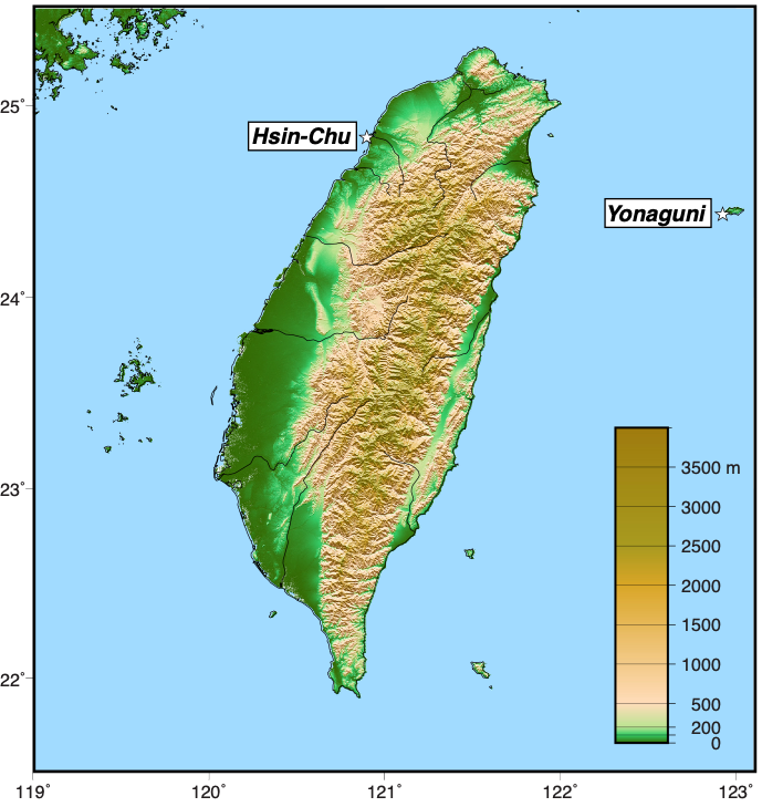
The PRECIP researchers chose Taiwan and southern Japan as their laboratory because the region has a consistently high level of moisture in the air that is a baseline requirement for heavy rain-producing storms. Then, they can look at all the subsequent processes and interactions that take place during weather events, according to Rasmussen.
Chungu Lu, a program director in NSF’s Division of Atmospheric and Geospace Sciences, added that precipitation forecasts have been lagging behind forecasts of other weather elements, such as temperature and wind, in terms of reliability and accuracy. “To improve that, we need to understand the fundamental processes controlling different levels of rainfall in weather systems,” Lu said. “PRECIP offers an opportunity to systematically study rainfall from typhoons as well as Asian summer monsoons, and rains affected by mountain ranges.”
Ground- and air-based technologies
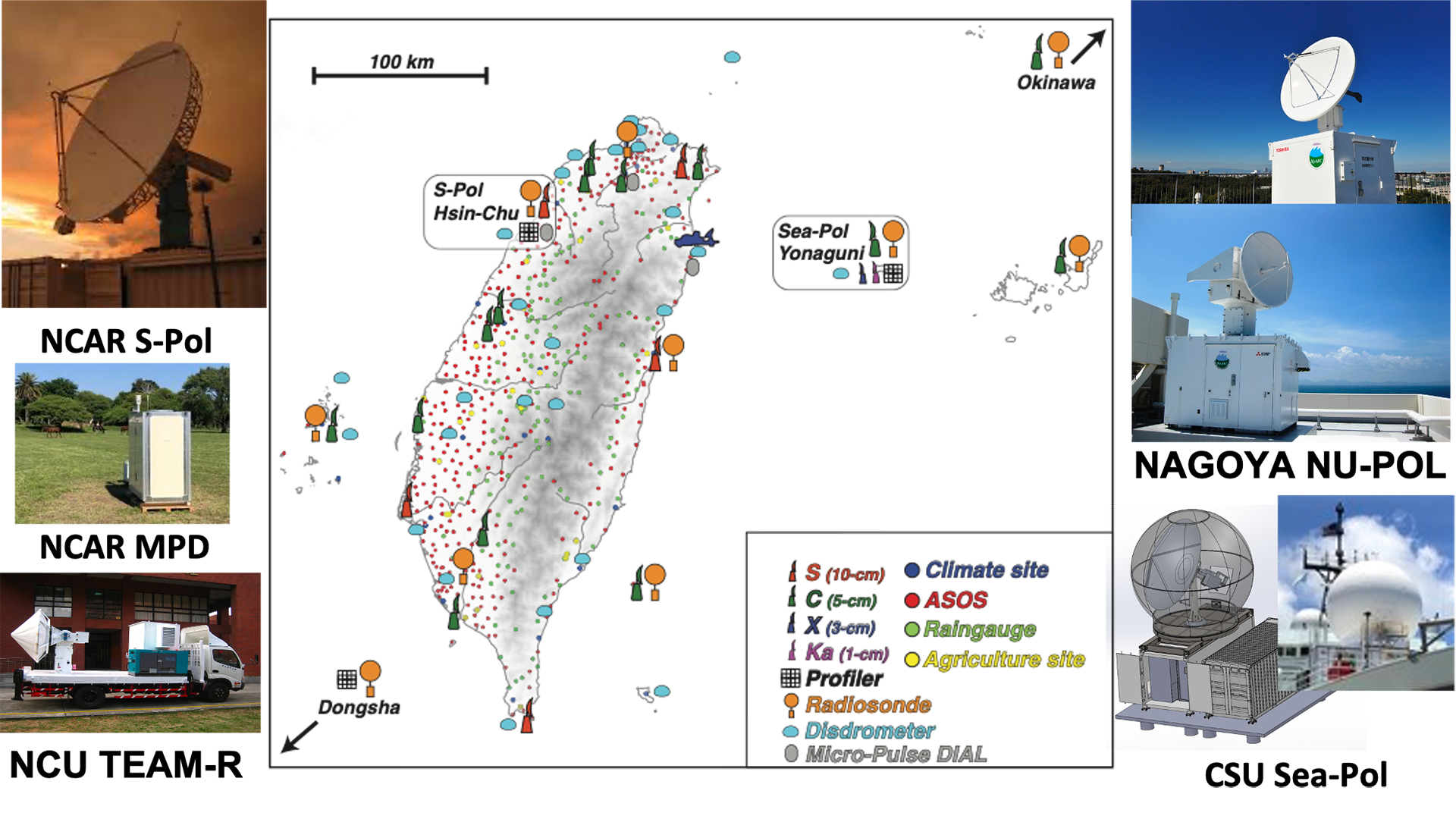
The PRECIP campaign will involve a large suite of technologies, ground- and air-based, that will provide unprecedented views of the inner details of storms and precipitation, as well as measurements of moisture, temperature and wind during rain events.
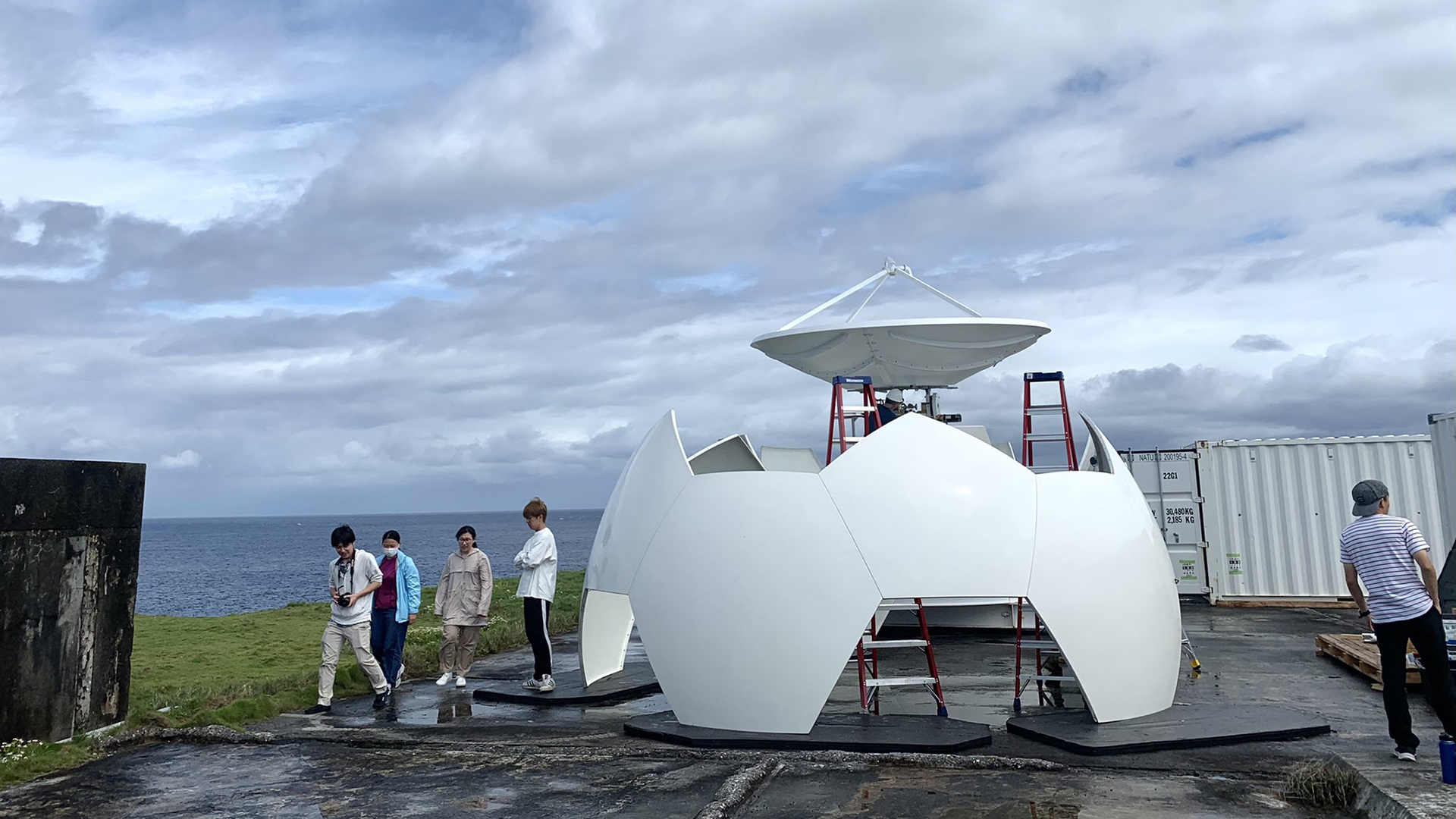
Among the signature pieces of technology will be a precipitation radar called SEA-POL, which was designed and built by CSU engineers and is now an NSF-supported community research radar. It was originally designed as a shipborne instrument, voyaging on three different seafaring missions before being deployed for PRECIP. SEA-POL is a dual-polarization radar, transmitting both horizontal and vertical electromagnetic waves that can “see” inside rain and clouds. It was also built to withstand very rugged weather and has a unique stabilization platform that corrects for ship movement. SEA-POL is based on Yonaguni island in Japan to collect data along with weather balloons and radars from Nagoya University.
The NCAR’s “S-Polka” radar is based in northwestern Taiwan and will also provide dual-polarization capabilities. The team will also deploy three MicroPulse DIAL instruments, which measure water vapor, as well as two aircraft from Taiwanese and Japanese partners that will fly through storms to collect additional data.