Unusual tropical cyclone activity in the South Indian Ocean that is causing loss of human life and devastation has caught the attention of CSU’s Tropical Meteorology Project, which has been issuing seasonal hurricane forecasts in the Atlantic longer than any other organization.
At the end of April, Tropical Cyclone Kenneth made landfall as the strongest tropical cyclone ever observed in Mozambique. Kenneth struck northern Mozambique hot on the heels of Tropical Cyclone Idai, which ravaged southeast Africa mid-March, killing more than 1,000 people. As this South Indian Ocean tropical cyclone season sets records, CSU’s Tropical Meteorology Project leaders offer some perspective on what is making it so unusual.
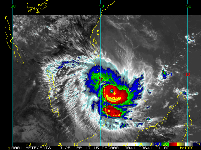
“Idai was extremely devastating from a loss-of-life perspective,” said researcher Phil Klotzbach, lead author of CSU’s Atlantic seasonal hurricane forecast. “Idai was a Category 2 hurricane when it made landfall, and it produced tremendous flooding as well as a very high storm surge. This devastating cyclone was responsible for more than 1,000 fatalities. This is the second most fatalities on record for a South Indian Ocean cyclone.”
Just over one month after Idai, Kenneth struck April 25 as a Category 4 storm with 140 mph winds. Though stronger than Idai, Kenneth has taken less of a toll on human life, with 41 known deaths as of this posting.
“Tropical Cyclone Kenneth made landfall as an extremely powerful storm in an area that hasn’t experienced a landfalling cyclone in over 50 years,” said Tropical Meteorology Project researcher Michael Bell, who is also an associate professor in the Department of Atmospheric Science. “The core of the cyclone was relatively compact, which limited the area that experienced very damaging Category 4 winds, but the largest impacts are expected to result from heavy rainfall.”
Pemba, capital of the province where Kenneth made landfall, received 23.4 inches of rain. Flooding is currently a serious ongoing issue in Kenneth’s wake.
“The cyclone’s huge rainfall generation was likely due to its slow speed as it approached the coast and then moved inland,” Klotzbach explained. Kenneth’s most unique aspect was where it made landfall. Typically cyclones strike farther south in Mozambique, he said.
An active season
An average South Indian Ocean tropical cyclone season, which is offset six months from the Northern Hemisphere season, has had 4.5 major hurricane-strength cyclones by this point, while this one has logged 11. What makes this such an active season?
Klotzbach noted that sea surface temperatures across most of the South Indian Ocean have been warmer than normal, providing fuel for cyclones. Vertical wind shear, which can tear apart storms before they intensify into cyclones, has been slightly lower this season in the latitudinal belt where South Indian Ocean cyclones form.
Klotzbach is quick to caution that linking the ocean’s temperature this particular season to climate change requires more extensive study, as natural climate variability also plays a role in modulating sea surface temperatures from year to year. Researchers only have a couple decades’ worth of reliable tropical cyclone data for the region. Quality satellite data for the area dates back only to the late 1990s.
“It’s certainly unusual to get two strong tropical cyclones hitting Mozambique in one year. This is the first time this has happened on record,” Klotzbach said. “While 11 major hurricane-strength cyclones in one season in the South Indian Ocean is the most on record, the reliability of tropical cyclone data in this region degrades rapidly prior to the mid-1990s.”