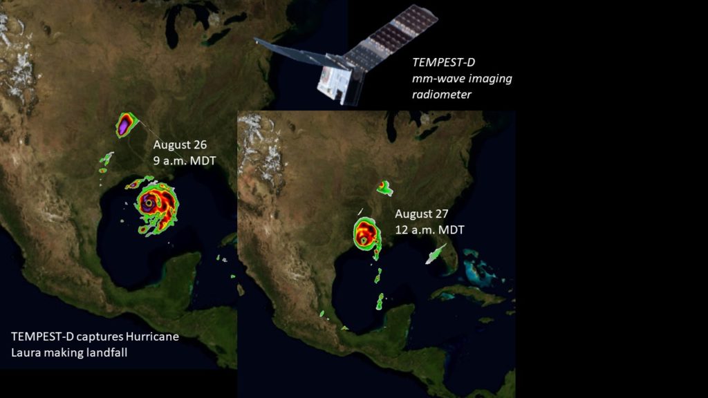
A tiny experimental satellite about the size of an Oxford dictionary has captured images of Hurricane Laura.
Developed by researchers and engineers at Colorado State University, CalTech/NASA’s Jet Propulsion Laboratory and Blue Canyon Technologies, the satellite, known as TEMPEST-D – short for Temporal Experiment for Storms and Tropical Systems – Demonstration – observed Hurricane Laura as a Category 3 hurricane approaching the Gulf Coast of Louisiana (left image) on Wednesday morning, August 26, at 9 a.m. MDT. Barely 15 hours later, TEMPEST-D again measured Laura making landfall near Cameron, Louisiana (right image) as a Category 4 hurricane with sustained winds of up to 150 mph on Thursday, August 27, at 12 a.m. MDT.
Small but mighty
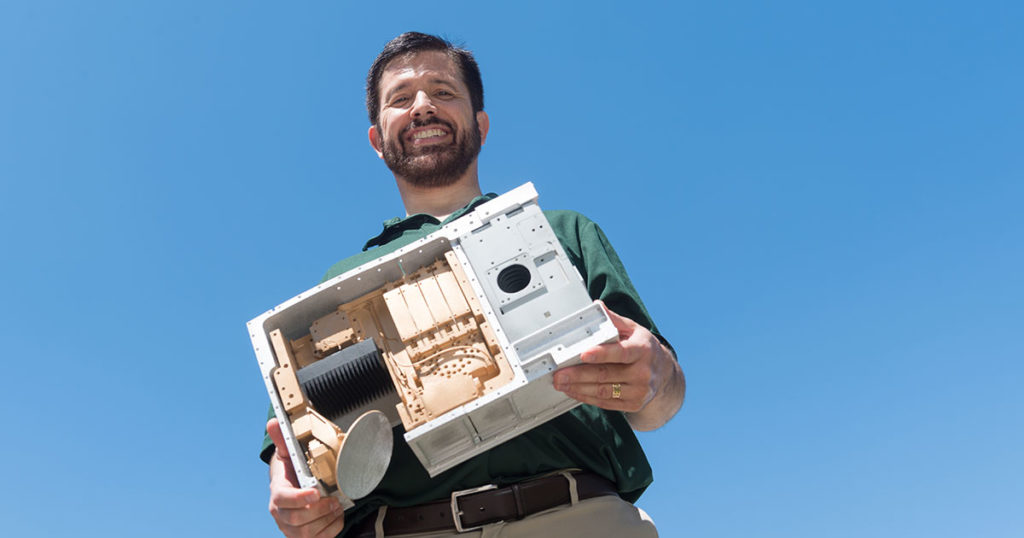
Now in its third year of operation, TEMPEST-D is an experiment in shrinking weather satellites to a size that makes them inexpensive enough to produce in larger quantities. The experimental weather satellite was deployed from the International Space Station two years ago in July, with a miniaturized microwave radiometer. It has now provided precise images of global weather from low-Earth orbit for more than two years, including three hurricane seasons. Measuring at five millimeter-wave bands, TEMPEST-D can see through clouds to reveal the interior of storms, revealing rain bands and areas where ice crystals have formed.
The TEMPEST-D mission is supported by NASA’s Earth Science Division Flight and Research Programs and led by Colorado State University, in partnership with NASA/Caltech Jet Propulsion Laboratory, Blue Canyon Technologies and NASA Wallops Flight Facility.
The TEMPEST-D principal investigator is Electrical and Computer Engineering Professor Steven C. Reising, with co-investigators Professors V. Chandrasekar, electrical and computer engineering, and Christian Kummerow, atmospheric science. CSU’s Cooperative Institute for Research in the Atmosphere, directed by Kummerow, hosts the TEMPEST-D data processing center, building on its strong heritage from NASA’s CloudSat mission.
The TEMPEST-D research team aspires to enable real-time storm coverage with many small satellites that can track storms around the world.