


It usually takes several days or even a week for a tropical storm to grow into a powerful hurricane. But if conditions are just right, a major hurricane can develop in just hours.
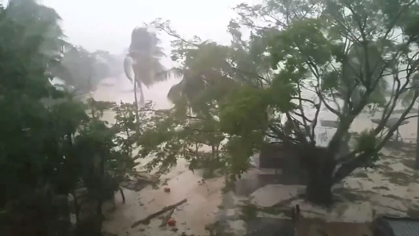
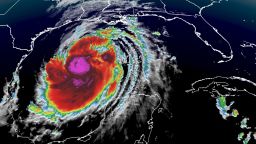
The process, known as “rapid intensification,” has taken Hurricane Laura from a tropical storm with sustained winds of 65 mph early Tuesday to a Category 3 with 115-mph winds on Wednesday morning. That increase in wind speed more than meets the threshold for “rapid intensification.”

And Laura is likely to continue picking up steam as is moves over the extremely warm Gulf waters, becoming a major Category 4 hurricane before landfall early Thursday.
A storm like this undergoes rapid intensification when its maximum sustained winds increase at least 35 mph in 24 hours or less, according to the National Hurricane Center. That’s a jump of about two categories on the Saffir-Simpson scale, which grades hurricane strength from 1 to 5.
Hurricane Michael, in 2018, was the last major hurricane in the Gulf of Mexico to rapidly intensify. It increased 46 mph in 24 hours as it approached landfall along the Florida Panhandle.
Both hurricanes Katrina and Rita, during the historic 2005 season, rapidly intensified before releasing devastating damage to the Gulf Coast.
Katrina increased 57 mph in an astonishing 18 hours. Rita, which followed a similar path to the one Laura is expected to traverse, increased by a whopping 69 mph in its first 24 hours in the Gulf of Mexico.
Perfect conditions are needed
While there isn’t much definitive data on rapid intensification, a few key atmospheric ingredients help it happen, CNN meteorologist Michael Guy said. They’re the same conditions that often emerge in the Atlantic basin between August and October.
Ocean water needs to be warm – more than 86 degrees Fahrenheit is ideal – with that heat extending beneath the surface. Upper level winds must be calm so they don’t disrupt thunderstorm activity.
A storm’s internal conditions also must be just right. A hurricane needs a way to ventilate, much like a car engine, so it can continue to process all of the fuel from the warm water and use it to strengthen the storm.
Rapid intensification is rare
Because all those pieces must be in place, rapid intensification is rare, with just one or two Atlantic storms per year undergoing such an acceleration.
That said, most storms that reach the highest categories – 3, 4 and 5 – reach these intensities through rapid intensification. Indeed, 70% of Atlantic storms that hit that mark do so through rapid intensification, according to a 2016 study published in Nature Communications.
In 2015, Hurricane Patricia, one of the strongest storms ever recorded, went through one of the fastest and most drastic rapid intensification cycles, with winds increasing about 120 mph in 24 hours.
These storms are more dangerous
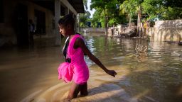
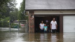
Storms that undergo rapid intensification tend to be more dangerous than other storms because they frequently end up as major hurricanes. Adding to the problem, the speed at which they strengthen allows for less warning time. This happened to those on the island of Dominica ahead of Hurricane Maria in 2017.
But it’s notoriously hard to predict rapid intensification because forecast models fail to pick up on all the different variables that feed into it – and because rapid intensification doesn’t always happen when the variables are present.
For instance, forecast models did not predict the rapid intensification in 2017 that made Hurricane Harvey a Category 4 storm in such a short period before it hit the Texas coast.
Storms are rapidly intensifying more frequently
The warmer waters extend beyond just the surface, going hundreds of feet deep, allowing plenty of heat content for hurricanes to use for fuel.
“If you increase the speed limit, you make more room for the storms to strengthen, so it can intensify more quickly,” according to Jim Kossin, an atmospheric research scientist at NOAA’s National Centers for Environmental Information.
This has led scientists to believe that storms are more likely to undergo “rapid intensification” as a result of climate change warming the oceans.
Some recent research has shown this increase observed in global tropical data, but the confidence in the data is low.
“We used to observe storms less frequently and with satellites that had lower resolution, and consequently, we likely couldn’t measure rapid intensification as well as we can now,” Phil Klotzbach, a research scientist at Colorado State University, told CNN.