Editor’s Note (8/21/20): Tropical Depression 13 has now strengthened and become Tropical Storm Laura.
Peak Atlantic hurricane season began yesterday. The greatest number of storms—especially major storms—typically form between Aug. 20 and Oct. 10.
But the start of the busy season is a bit more troubling than usual this year. The early part of the season has already been abnormally active.
On supporting science journalism
If you're enjoying this article, consider supporting our award-winning journalism by subscribing. By purchasing a subscription you are helping to ensure the future of impactful stories about the discoveries and ideas shaping our world today.
So far, 11 named storms have already formed in the Atlantic basin. The National Hurricane Center names a storm once it reaches tropical storm levels. Two of them—Hanna and Isaias—strengthened into hurricanes.
Meanwhile, two more tropical depressions are already churning in the Atlantic basin, one in the Caribbean Sea and the other just west of the Caribbean islands. If they strengthen into tropical storms, they’ll be the 13th and 14th named storms this year.
An average season, on the other hand, typically sees only around two named storms by the beginning of August. An entire season, which concludes at the end of November, usually sees around 12.
In other words, the early part of this season has already seen nearly as many storms as an entire hurricane season would typically produce.
Unusual weather activity these days often begs the question: Is climate change playing a role? Are we catching a glimpse of what may eventually become a “new normal” in a warming world?
In this case, there’s a bit more going on.
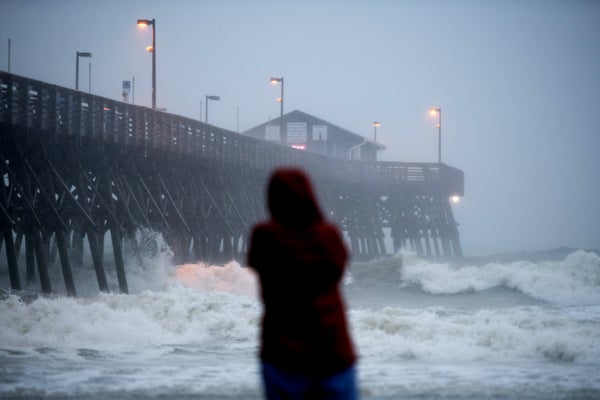
While this season has produced a parade of tropical storms and hurricanes, none of them has achieved major storm status, typically defined as a Category 3 hurricane or higher. Both Hurricanes Hanna and Isaias topped out as Category 1 storms.
That’s not to say they didn’t cause their fair share of trouble. Both storms left flash flooding and widespread power outages in their wake.
But the total number of hurricanes isn’t necessarily a symbol of the changing climate.
In the first place, there’s a surprising amount of uncertainty about how many storms are “normal” to begin with. Reliable hurricane records only go back to about the 1950s, and the best data starts with the satellite record in the 1970s. That means scientists don’t actually have a ton of long-term data on what constitutes a typical hurricane season.
That said, climate models generally don’t predict a big future increase in the frequency of tropical cyclones. Rather, they suggest that the storms that do form will be more intense.
In other words, there’s likely to be around the same number of storms each year as the climate continues to warm—but a greater proportion of them will be major storms.
What’s happening in the Atlantic this year?
It’s true that high temperatures—specifically warm water in the Atlantic Ocean—have helped fuel this year’s active season.
Sea surfaces have been unusually warm throughout much of the Atlantic basin this summer. And warm waters are more favorable for storm formation.
At the same time, a number of other meteorological conditions have also lined up this summer, making it easier for storms to form.
“We’re seeing not only just warmer sea surface temperatures, we’re also seeing lower sea level pressures,” said Jhordanne Jones, a graduate research assistant with Colorado State University’s Tropical Weather and Climate Research Group. “Lower sea level pressure will very likely favor convection and the development of storms.”
And wind conditions in the region have also favored storm formation, she added.
The warm Atlantic waters have likely been influenced by a number of factors. Natural climate cycles, which swing between warmer and cooler phases every decade or so, have probably played a role. And climate change certainly is contributing to ocean warming.
But there’s another, less obvious factor that may be affecting the frequency of Atlantic storms in recent years.
As pollution levels in the United States and Europe have fallen, the climate over the Atlantic has warmed a bit faster than it otherwise would have. That’s because certain types of air pollution actually have a cooling effect in the atmosphere.
“From the 1950s to the late 1970s, big time, we were ramping up sulfate emissions, which are a byproduct of fossil fuel combustion,” said Kerry Emanuel, a hurricane expert at the Massachusetts Institute of Technology.
This pollution dampened temperatures in the tropical Atlantic for several decades. And some experts believe that hurricane activity was dampened, as well.
“We think it was mostly a man-made phenomenon, that we caused a kind of hurricane drought in the ‘70s and ’80s,” Emanuel said.
Starting in the 1970s, both the United States and Europe began making strides in reducing their air pollution. The Clean Air Act was a key regulation in the United States around this time. Sulfate emissions dropped, and the region began to warm up at faster rates.
At the same time, beginning around the early ’80s, hurricane activity in the Atlantic appeared to increase again.
There’s still some debate among scientists about whether the pollution was the major factor or whether natural climate cycles played a bigger role, Emanuel noted.
But Jim Kossin, a hurricane expert at NOAA, also pointed to pollution as at least one key factor in Atlantic hurricane frequency over the last few decades.
Global warming has also been raising sea surface temperatures everywhere for the last few decades, he noted. But falling pollution levels have helped speed up warming specifically over the Atlantic.
This may have helped hurricane activity ramp back up to where it would have been without all the pollution of the 1950s and ’60s.
“How much of it is due to greenhouse gas increase, how much of it is due to pollution decreases, and how much of it is due to natural variability? There’s a whole lot of really smart people working on that question, and we don’t have a definitive answer to it yet,” Kossin said. “Almost everyone agrees it’s a combination of the three.”
A look into the future
Since warm ocean waters play such a big role in hurricane formation, it seems logical that more warming should further increase the number of storms that form each year. But it’s not that simple, experts say.
Climate change affects more than just ocean temperatures in the Atlantic. It also alters the temperature and physical structure of the atmosphere, and it affects wind patterns, as well.
And climate models suggest that the way the atmosphere changes over the Atlantic in the coming decades is actually less conducive to hurricane formation.
According to the models, future warming “has a tendency to sort of stabilize the air, and it tends to dry out the middle layers of the atmosphere,” Kossin said. “Now both of these things are very bad for [hurricane] genesis.”
With the atmospheric changes on the one hand, and the warming waters on the other, it’s actually not surprising that models don’t predict an increase in the number of hurricanes that form each season. In fact, models suggest that some parts of the world may actually see a slight decrease in the total number of annual storms.
But warm water doesn’t just affect the likelihood that a storm will form in the first place. It also influences how intense the storm will get. Warmer water tends to favor stronger storms.
Accordingly, climate models project that hurricanes will be more intense in the future.
In fact, some research suggests that it’s already happening. A study published earlier this year in Proceedings of the National Academy of Sciences, led by Kossin, found that cyclone intensity has been increasing over the last four decades.
So what about the rest of this year?
Researchers at Colorado State University release an Atlantic hurricane forecast each year. The team recently updated this season’s forecast, predicting an “extremely active” 2020 season.
The new forecast calls for 24 named storms, 12 of which become hurricanes and five of which turn into major storms. A typical season sees six hurricanes, only three of which achieve Category 3 or higher.
If the forecast holds true, that means both an above-average number of storms and an above-average number of intense storms for 2020.
The proportion of intense storms—about half the total number of hurricanes—is still projected to be about average this year. But that could change in the coming years.
And while the number of storms has grabbed public attention this year, the strength of the hurricanes is really the thing to pay attention to in the end, Emanuel said.
“We’ve had all these storms this year, and not one of them has become very strong at all, nor has any one of them done a lot of damage,” he told E&E News. “What the people who have to make decisions are worried about is the intense storms. And what we really ought to be focused on is what controls their frequency. And unfortunately what the models show is the frequency of those guys going up, even if the [total] frequency of storms goes down.”
Reprinted from Climatewire with permission from E&E News. E&E provides daily coverage of essential energy and environmental news at www.eenews.net.