Colorado State University hurricane researchers continue to predict a near-average Atlantic hurricane season. They cite both near-average sea surface temperatures in the tropical Atlantic and a weakening El Niño event in the tropical Pacific as the primary reasons for the near-average prediction. El Niño tends to increase upper-level westerly winds across the Caribbean into the tropical Atlantic, tearing apart hurricanes as they try to form. While El Niño has weakened over the past several months, they anticipate that lingering warming in the central tropical Pacific should be a slight inhibiting factor for the remainder of the hurricane season.
The tropical Atlantic currently has near-average sea surface temperatures. A warmer tropical Atlantic provides more fuel for developing tropical cyclones. Increased tropical Atlantic warmth is also associated with moister air and a more unstable atmosphere, both of which foster organized thunderstorm activity necessary for hurricane development.
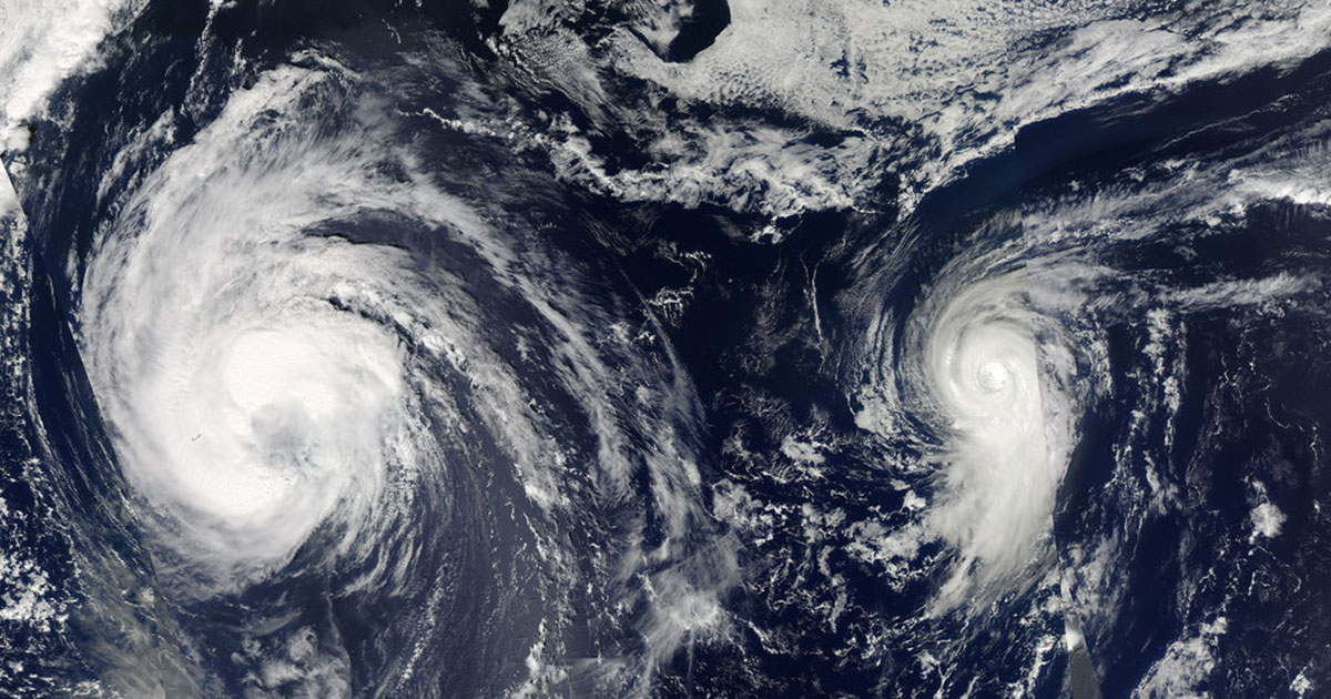
Vertical wind shear was slightly stronger than normal across the Caribbean in July. This tends to be associated with quieter Atlantic hurricane seasons.
12 additional named storms
The CSU Tropical Meteorology Project team is predicting a total of 12 additional named storms to form after Aug. 1. Of those, researchers expect six to become hurricanes and two to reach major hurricane strength (Saffir/Simpson category 3-4-5) with sustained winds of 111 miles per hour or greater. These forecast numbers do not include Subtropical Storm Andrea and Hurricane Barry, which formed prior to Aug. 1.
The team based this forecast on 40 years of historical data that include Atlantic sea surface temperatures, sea level pressures, vertical wind shear levels (the change in wind direction and speed with height in the atmosphere), El Niño (warming of waters in the central and eastern tropical Pacific), and other factors.
So far, the 2019 hurricane season is exhibiting characteristics similar to 1990, 1992, 2012 and 2014. “1992 and 2014 had below-average Atlantic hurricane activity, 1990 had near-average hurricane activity, and 2012 had above-average Atlantic hurricane activity,” said Phil Klotzbach, research scientist in the Department of Atmospheric Science and lead author of the report.
The team predicts that 2019 hurricane activity will be about 100 percent of the average season. By comparison, 2018’s hurricane activity was about 125 percent of the average season. The 2018 season was most notable for Hurricanes Florence and Michael, which devastated the Carolinas and portions of the Florida Panhandle, respectively.
This is the 36th year that the CSU hurricane research team has issued their Atlantic basin seasonal hurricane forecast. Recently, the Tropical Meteorology Project team has expanded to include Michael Bell, associate professor in the CSU Department of Atmospheric Science, and Jhordanne Jones, graduate research assistant in the same department. Bill Gray, who originated the seasonal forecasts, launched the report in 1984 and continued to author them until his death in 2016.
The CSU forecast is intended to provide a best estimate of activity in the Atlantic during the upcoming season – not an exact measure.
As always, the researchers caution coastal residents to take proper precautions.
“It takes only one storm near you to make this an active season,” Bell said.
Landfalling probability included in report
The report also includes the post-July 2` probability of major hurricanes making landfall in the continental U.S. and Caribbean:
- 53 percent for the entire U.S. coastline (full-season average for the last century is 52 percent)
- 31 percent for the U.S. East Coast including the Florida peninsula (full-season average for the last century is 31 percent)
- 31 percent for the Gulf Coast from the Florida panhandle westward to Brownsville (full-season average for the last century is 30 percent)
- 43 percent for the Caribbean (full-season average for the last century is 42 percent)
The forecast team also tracks the likelihood of tropical storm-force, hurricane-force and major hurricane-force winds occurring at specific locations along the coastal United States, the Caribbean and Central America through its Landfall Probability website.
The site provides information for all coastal states as well as 11 regions and 205 individual counties along the U.S. coastline from Brownsville, Texas, to Eastport, Maine. Landfall probabilities for regions and counties are adjusted based on the current climate and its projected effects on the upcoming hurricane season.
The CSU team updates the site regularly with assistance from the GeoGraphics Laboratory at Bridgewater State University in Massachusetts.
Funding for this year’s report has been provided by Interstate Restoration, Ironshore Insurance, the Insurance Information Institute, Weatherboy and a grant from the G. Unger Vetlesen Foundation.
ATLANTIC BASIN HURRICANE FORECAST FOR 2019:
-Released Aug. 5, 2019-
Tropical Cyclone Parameters Extended Range
(1981-2010 Climatological Average Forecast for 2019 in parentheses)
Named Storms (12.1)* 14**
Named Storm Days (59.4) 55
Hurricanes (6.4) 7
Hurricane Days (24.2) 20
Major Hurricanes (2.7) 2
Major Hurricane Days (6.2) 5
Accumulated Cyclone Energy (106) 105
Net Tropical Cyclone Activity (116%) 110
* Numbers in ( ) represent averages based on 1981-2010 data.
** Forecast numbers include tropical cyclones that formed prior to Aug. 1.